Overview
Completed Basic Geographic Information System Using ArcGIS training from Kelas Engineer by PT. Zaada Bana Engineering. This comprehensive 4-day training (10 hours total) provided hands-on experience with ArcGIS software and fundamental GIS concepts for spatial data analysis and map creation.
Topics Covered
- Introduction to GIS & ArcGIS - Understanding Geographic Information Systems and ArcGIS platform
- Spatial Data Input - Learn how to input and add spatial data into GIS projects
- Coordinate Systems & Projection - Introduction to coordinate systems, projection, and georeferencing
- Shapefile Creation & Editing - Create and edit shapefiles (digitization) for spatial features
- Spatial Analysis - Learn basic spatial analysis techniques and coordinate creation
- Map Layout & Styling - Learn topology error handling, labels styling, and map layouting
Key Results
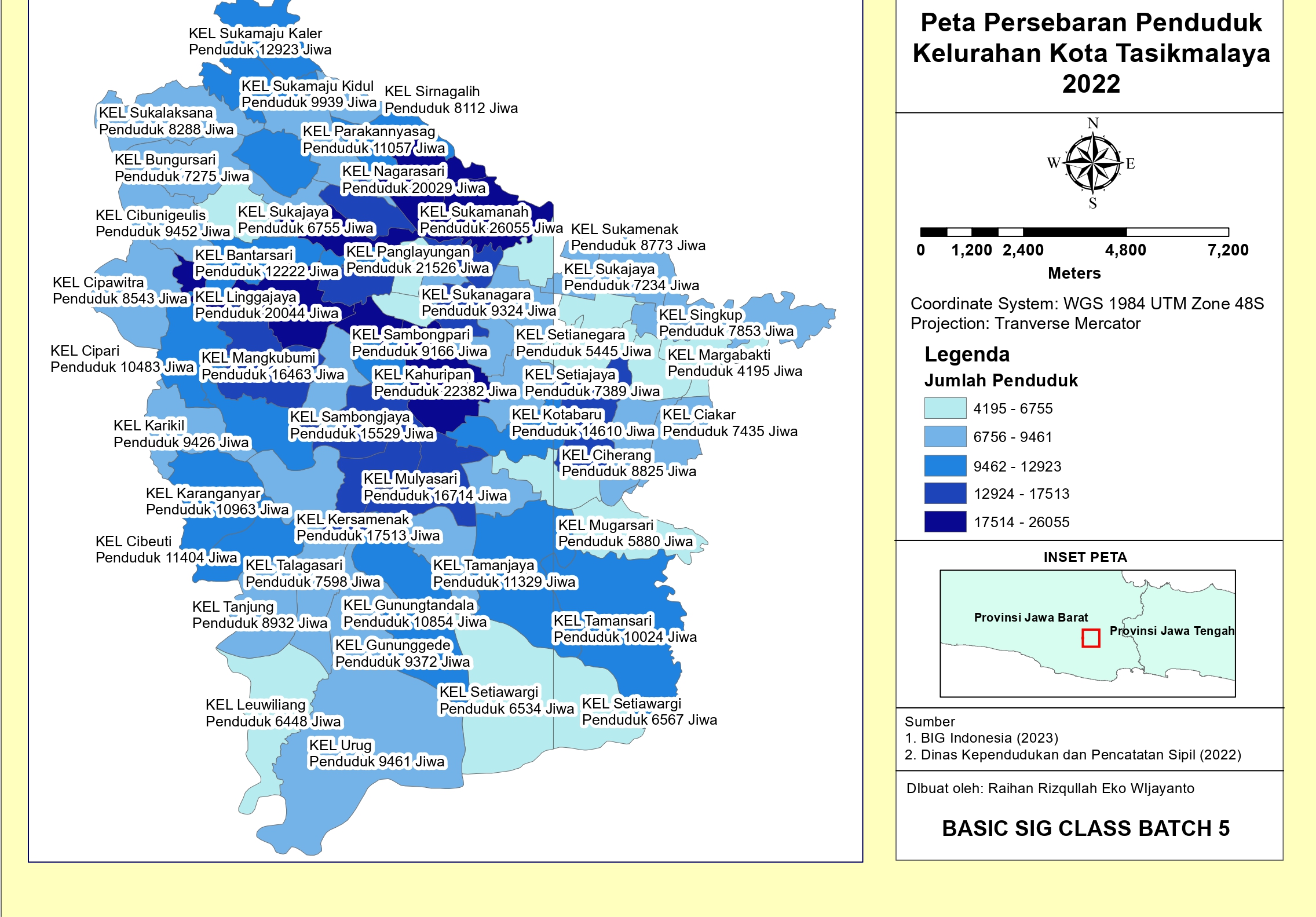
- Created population distribution map of Tasikmalaya City 2022 as final project
- Mastered fundamental GIS workflows from data input to map production
- Developed proficiency in ArcGIS software for spatial data management
- Gained hands-on experience in digitization, georeferencing, and map layouting
Documentation
Course Details
Duration
4 days - January 2024
Format
Online - Live training sessions
Tools & Technologies
 ArcGIS
GIS
Spatial Data
Georeferencing
Digitization
ArcGIS
GIS
Spatial Data
Georeferencing
Digitization